
New York City’s public transportation system is one of the most extensive and efficient in the world. Learning to navigate it can be challenging for newcomers and visitors alike. We will help you navigate public transport in New York City with ease. From the subway to buses and alternative options, understanding these systems will enhance your experience in the city. With millions of residents and tourists using the system daily, it’s essential to know how to get around. For those planning a move to or from the city, check out Verified Movers reviews for reliable moving company options.
Understanding the Different Modes of Public Transportation
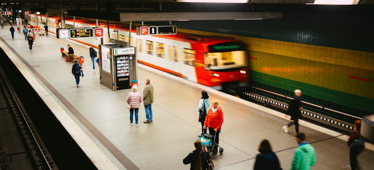
New York City offers various modes of public transportation to get around efficiently. The primary options include the subway, buses, and commuter trains. Each mode has its own benefits and ideal use cases. The subway is often the fastest way to travel long distances within the city, covering all five boroughs. Buses provide more direct routes to specific neighborhoods and can be more accessible for certain locations. Commuter trains connect NYC to surrounding areas, such as New Jersey, Connecticut, and Long Island, making it easier for those who live outside the city but work within it. Understanding these options will help you navigate public transport in New York City effectively. For those moving to or from the city, consider the top movers in NYC for a worry-free move.
How to Use the NYC Subway System?
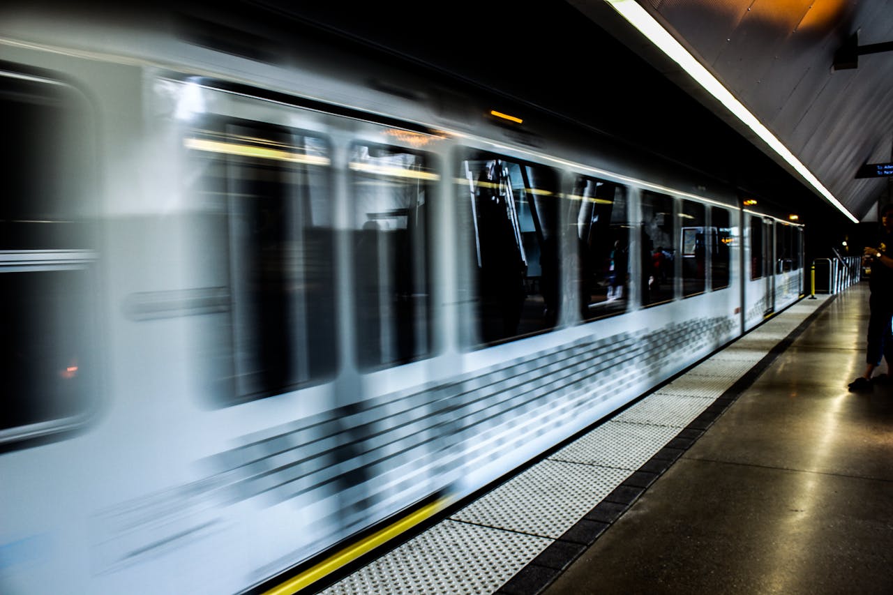
The NYC subway system is the largest in the United States, with 472 stations across the city. To use the subway, start by purchasing a MetroCard, which can be used for both subways and buses. Maps are available at every station, and many mobile apps can help you plan your route. Trains run 24/7, but service frequency varies depending on the time of day. During peak hours, trains run more frequently, while late-night service may have longer wait times. Those moving to this city should check out cross-country movers from NYC. The subway is a key component to navigating public transport in New York City and reaching your destination quickly.
Tips for subway use
Navigating the subway can be daunting, but these tips will make it easier:
- Peak hours: Avoid peak hours (7-9 AM and 5-7 PM) if possible, as trains can be very crowded.
- Express vs. local trains: Understand the difference between express and local trains. Express trains skip certain stops, so make sure your stop is on the express route.
- Safety: Always stay aware of your surroundings and keep your belongings secure. Stand away from the platform edge and do not lean over.
Purchasing and using a MetroCard
A MetroCard is essential for using the subway and buses in New York City. You can purchase one at any subway station from vending machines or station agents. There are two types of MetroCards: Pay-Per-Ride and Unlimited Ride. The Pay-Per-Ride card deducts the fare each time you use it, while the Unlimited Ride card allows for unlimited rides within a set period. For tourists or frequent users, the Unlimited Ride card often provides the best value.
Navigating by Bus
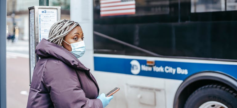
Buses are a vital part of New York City’s public transportation network. They cover areas not served by the subway and provide a more scenic way to travel. To use the bus, you can use the same MetroCard as for the subway. Bus stops are located at street corners, and each stop has a sign indicating the bus routes that stop there. Buses operate 24/7, but service frequency varies. Using buses is another essential way to navigate public transport in New York City after moving here with the help of long distance movers New York City, who are the best.
Bus routes and schedules
Each bus route is identified by a letter and a number, such as M15 or B41. The letter indicates the borough where the bus primarily operates: M for Manhattan, B for Brooklyn, Q for Queens, Bx for the Bronx, and S for Staten Island. Schedules and route maps are available at bus stops and online. Mobile apps can also provide real-time bus arrival information.
Transfers and accessibility
Transfers between buses, and between buses and the subway, are free within two hours of your initial fare payment. This makes it easy to switch modes of transport without incurring additional costs. Most buses are equipped with ramps or lifts, making them accessible to passengers with disabilities. Priority seating is available for seniors and passengers with disabilities.
Alternative Public Transport Options
Besides the subway and buses, New York City offers alternative public transport options. These include ferries, bike-sharing programs, and ride-sharing services. Ferries provide a scenic way to travel between boroughs, especially to Staten Island, Brooklyn, and Queens. The NYC Ferry system is affordable and offers stunning views of the city skyline. Bike-sharing programs, such as Citi Bike, allow you to rent bikes at various locations throughout the city. Ride-sharing services like Uber and Lyft are widely available and can be convenient for short trips.
NYC Ferry
The NYC Ferry system operates on several routes, connecting Manhattan with Brooklyn, Queens, and the Bronx. Ferries run frequently and provide a comfortable and scenic alternative to subways and buses. The ferry terminals are equipped with ticket machines and waiting areas. Tickets can be purchased in advance online or via the NYC Ferry app.

Citi Bike
Citi Bike is New York City’s bike-sharing program, offering thousands of bikes at hundreds of stations across the city. Bikes can be rented and returned at any station, making it a flexible and convenient way to travel short distances. A Citi Bike day pass allows for unlimited 30-minute rides, while an annual membership offers even more benefits. This program is especially popular during the warmer months. Check out some moving tips If you’re moving to the city, to make your relocation as easy as possible.
Ride-Sharing Services
Ride-sharing services like Uber and Lyft offer another convenient option for getting around the city. These services can be booked through their respective mobile apps and provide door-to-door service. They are especially useful for trips to and from airports, late-night travel, or when public transport options are limited. If you are shipping a car from California to New York for added convenience, you may not need these services.
Safety Tips for Using Public Transport
Safety is crucial when using public transport in New York City. Here are some tips to stay safe:
- Stay alert: Always be aware of your surroundings. Keep your belongings secure and avoid displaying valuables.
- Travel light: Carry only what you need. A small bag is easier to manage and less likely to be targeted.
- Use well-lit areas: Stay in well-lit areas, especially at night. Choose well-populated train cars and bus stops.
- Know emergency exits: Familiarize yourself with emergency exits and procedures for each mode of transport.
- Stay informed: Follow official MTA updates on service changes and delays to avoid unnecessary disruptions.
Mobile Apps and Resources to Help You Navigate
Several mobile apps and online resources can help you navigate public transport in New York City. These tools provide real-time information on schedules, routes, and service changes. Popular apps include:
- MTA Subway Time: Provides real-time subway arrival information and service alerts.
- Citymapper: Offers comprehensive transit directions, including subways, buses, and bike-sharing options.
- Google Maps: A reliable option for planning routes and checking transit schedules.
- Transit App: Real-time updates on all forms of public transport in the city.
These apps are invaluable for both residents and visitors, providing up-to-date information to make your journey easier.

Dealing with Delays and Service Changes
Navigating New York City’s public transportation can be challenging when delays and service changes occur. Knowing how to handle these disruptions can save time and reduce stress. Keep an eye on service alerts and plan alternative routes. Apps like MTA Subway Time and Citymapper provide real-time updates and suggest alternative routes. If you encounter a delay, stay calm and patient. Use the extra time to plan your next steps or catch up on messages. For those moving, learning some packing secrets can also help with unpacking and leaving you time to navigate public transport in New York City.
Tips for managing delays
- Check alerts: Always check for service alerts before starting your journey. The MTA website and transit apps provide the latest updates.
- Have a backup plan: Know alternative routes and modes of transport. If your usual subway line is delayed, consider taking a bus or walking a few blocks to another line.
- Stay connected: Use your smartphone to stay informed and connected. Many stations and buses offer free Wi-Fi, so you can check updates and communicate with others if plans change.
Using Commuter Trains
In addition to the subway and buses, New York City is served by several commuter train lines that connect the city with surrounding regions. These include the Long Island Rail Road (LIRR), Metro-North Railroad, and New Jersey Transit (NJ Transit). Commuter trains are a popular choice for those living in the suburbs and working in the city.
Long Island Rail Road (LIRR)
The LIRR operates out of Penn Station in Manhattan and serves Long Island, including popular destinations like Jamaica, Hicksville, and Montauk. The LIRR is the busiest commuter railroad in North America, with over 300,000 daily riders. Tickets can be purchased at stations, via ticket machines, or through the MTA eTix app.
Metro-North Railroad
Metro-North connects New York City with the northern suburbs, including Westchester, Putnam, and Dutchess counties, as well as parts of Connecticut. The main terminals are the Grand Central Terminal in Manhattan and the Harlem-125th Street station. Metro-North offers frequent service, especially during peak hours, and is known for its reliability and comfort.
Understanding Fares and Payment Options
Navigating the fare system is crucial for using public transport in New York City. Each mode of transport has its own fare structure, and understanding these can save you money and make your travel easier.
Planning Your Route
Effective route planning is key to navigating public transport in New York City. Whether you are a daily commuter or a first-time visitor, having a plan can make your journey more efficient. After creating a moving checklist, you should focus on exploring your new city.

Using maps and guides
Official MTA maps are available at all subway stations and can be downloaded online. These maps provide an overview of the entire subway and bus network, helping you plan your route. Online resources, such as the MTA website, offer interactive maps and trip planners that provide step-by-step directions.
Exploring Neighborhoods by Public Transport
New York City is a collection of diverse neighborhoods, each with its own unique character. Public transport makes it easy to explore these areas and discover what they have to offer. Visit the NYC Government’s Neighborhood Profiles For more information on the neighborhoods and their characteristics.
Manhattan
Manhattan is the heart of New York City and home to many of its most famous landmarks. The subway provides quick and easy access to attractions such as Central Park, Times Square, and the Empire State Building. Buses can take you along the scenic routes of Fifth Avenue and Broadway.
Brooklyn
Brooklyn is known for its cultural scene and historic neighborhoods. The subway connects Manhattan to Brooklyn via several lines, making it easy to visit places like Williamsburg, DUMBO, and Coney Island. The NYC Ferry also offers a scenic route along the East River, with stops in Brooklyn and Queens.
Queens
Queens is the most diverse borough in New York City, offering rich culture and cuisines. The subway and buses connect you to neighborhoods like Astoria, Flushing, and Jackson Heights. Citi Field, home of the New York Mets, and Flushing Meadows-Corona Park are major attractions in Queens.
Navigate Public Transport in New York City With Ease!
Mastering the public transportation system in New York City is key to getting around efficiently. Whether you’re using the subway, buses, or alternative options, understanding how to navigate these systems will enhance your experience. Use mobile apps and follow safety tips to make your journey smoother. By learning to navigate public transport in New York City, you’ll be able to explore all the dynamic and diverse neighborhoods the city has to offer!